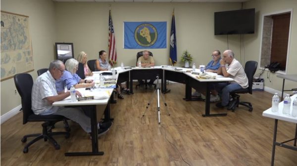
SALYERSVILLE – The Salyersville City Council met in regular session on Monday, October 19.
During the meeting, councilmen Paul Montgomery and Tex Holbrook asked Mayor Stanley Howard about the resurfacing at Coal Branch, with Mayor Howard noting they were resurfacing all but two spots of Coal Branch. They asked about getting the price for the city to resurface the whole thing, not leaving out the two spots and Howard said they can check on that.
He also noted that he had applied for 13 roads for the LARP (Local Assistance Road Program Funding) program and the five roads were all that were approved.
As we reported earlier this year, from Open Records Request returns, on the LARP applications turned in last year, the city had only applied for funding for five city roads. For that information, see the info below this article.
The council awarded the bids for resurfacing to Hinkle.
Eric Ratliff with Big Sandy Area Development District presented a bill for $9,000 for Bell Engineering for the Parkway Beautification Project. He presented a bill for BOCA Enterprises for $181,800 for sewer installation of grinder pumps. He said they have 70 installed, so they are about one-third of the way through that project. For Summit Engineering, he had a bill for $16,804 for sewer inspection. The council approved to pay all three bills, all paid for by grant funding.
The next regular Salyersville City Council meeting is tentatively set for November 16 at Salyersville City Hall.
Let’s look at LARP
From returns of Open Records Requests, the SI confirmed that the City of Salyersville did have blacktopping for portions of 15 roads assessed and quoted by Hinkle in February 2024. Those roads included: Allen Drive, Auxier Branch, Back Street, Coal Branch, Combs Street, Conley Street, Dixie Avenue, Flint Street, Henry Arnett Branch, Howard Street, Jeff Lovely Hill, Lee Prater, Patrick Drive, Sugar Camp Road and Ward Road, as well as the walking track at Ramey Memorial Park. The estimates do not include any road ranking as far as how bad the roads were and the quotes were listed as only being good for 15 days.
As far as what roads the mayor applied for under Local Assistance Road Program Funding (LARP), in the application submitted to the Kentucky Transportation Cabinet’s Department of Rural and Municipal Aid for the County Priority Projects Program, dated for April 2025, it appears Howard applied for resurfacing or patching of a total of five city streets as follows in the order they were applied for, claiming there are a total of 68 constituents affected by the roads requested:
– Sugar Camp Rd.
– Resurfacing of 0.3 miles, located just before Back St. entrance at 0.066 mile marker on Sugar Camp Rd. and running to ending mile point 0.4.
– Resurfacing of 0.6 miles, located after the bridge on Sugar Camp Rd. and before the intersection of Sugar Camp Rd. and Sugar Camp Spur, beginning at mile marker 0.00 and ending at mile point 0.56.
– Henry Arnett Br., resurfacing of 0.1 miles, located at the intersection of Coal Brach Rd. and Henry Arnett Br., beginning at 0.00 mile point and ending at the end of Henry Arnett branch at ending point 0.117. Project’s estimate cost of $16,731.25. Important to note, this is the mayor’s street.
– Flint Street, resurfacing of 0.1 miles, located at the intersection of Coal Branch Rd. and Flint St., beginning at mile point 0.00 to the end of Flint St. at ending mile point 0.1. Also important to note, this is the mayor’s brother’s road.
– Allen Drive
– Patching of 0.1 miles, located at 0.04 miles from the intersection of Parkway Drive and Allen Drive, starting at mile point 0.04 and continuing to the ending mile point of 0.1, patching a utility break.
– Patching of 0.1 miles, starting at mile point 0.077 to mile point 0.085, also to patch a utility break.
– Patching of 0.1 miles, located from the mile point 0.091 to mile point 0.097.
– Patching of 0.1 miles, starting at mile point 0.206 and ending at mile point 0.21.
– Patching of 0.1 miles, beginning at mile point 0.357 to ending mile point 0.39.
– Patching of 0.1 miles, beginning at mile point 0.495 and ending at mile point 0.506.
– Conley Street, resurfacing 0.1 miles, located at the intersection of East maple Street and Conley Street, beginning at mile point 0.00 and ending at mile point 0.1 on Conley Street.
LARP was established by House Bill 546 to provide an addition option for local governments to secure state funding for road projects. It is administered by the Department of Rural and Municipal Aid within the Kentucky Transportation Cabinet. The maximum state contribution per project is capped at $500,000, though local governments can contribute additional funding to complete a project.
Under LARP, roads do have to follow a scoring criteria, with applications to be evaluated using a standardized scoring system based on: safety, congestion relief, asset management and cost effectiveness, and to include a 10% match from the City of Salyersville.
During the 2026 Legislative Session, the legislators passed a state biennial transportation budget, which itemizes the funded projects, and in that the following projects were included for the 2027 fiscal year, totaling $67,400 for Salyersville city streets:
– Henry Arnett St. – $16,000
– Sugar Camp Rd. – $19,000
– 3 portions of Allen Dr. – $5.300 each
– Only one listed as to “relieve hazardous condition”
– Conley St. – $6,100
– Flint St. – $10,400
So, no, it does not appear “all of the city streets” were included in the application for LARP funding. The scoring criteria is still not completely explained, but we’re still waiting on an ORR to help clarify that, if possible, or if an assessment scoring all roads in the city was completed. The mayor’s own road and his brother’s road were both included on the first page prioritizing the roads the city requested LARP funding for, regardless of those being low population and low traffic areas.
This is an ongoing issue and the SI will continue to follow and provide updates as information becomes available.